The Spanish-American War
Fidel Castro
The Bay of Pigs
Embargo
Guantanamo Bay
The Future of Cuba
|
The Spanish-American War Fidel Castro The Bay of Pigs Embargo Guantanamo Bay The Future of Cuba
0 Comments
My Number is (918) 314-5994 if you have any questions
Peru Today -- Read pages 247-251 Lesson Review Due at the end of the Hour #1 Definition of Oasis #2 Compare Rural and Urban areas in Peru #3 Describe three types of landforms in Peru #4 Describe the challenges to Peru's economy #5 Which group makes up the largest part of Peru's population Movie if there is extra time City of Ghosts -- Archeology in the Desert of Peru Bella has Strepthroat.
Social Studies Textbook Brazil Today - Chapter 9 - Core Lesson 3 Pages 242 - 246 Due by the End of the Hour Lesson Review on Page 246 #1 Vocabulary - Use Inflation in a paragraph #2 Reading Skill - Describe how the government of Brazil tried to deal with the problem of overcrowding? Did it help? #7 Timeline Skill - How many years after Brazil gained Independence from Portugal did it form a democratic government? Timeline on Page 246 South America is the fourth largest continent in size and the fifth largest in population. It is located primarily in the southern hemisphere. It is bordered by the Atlantic Ocean to the east and the Pacific Ocean to the west. The geography of South America is dominated by the Andes Mountain Range and the Amazon River (second longest river in the world). Prior to European colonization, the Incan Civilization was a dominant force in South America. In the 1500's, Spain and Portugal colonized much of South America. The colonies gained independence in the 1800's with the help of leaders such as Simon Bolivar and Jose de San Martin. Much of South America still speaks Spanish or Portuguese as their primary language. Population: 387,489,196 (Source: 2010 United Nations) Click here to see large map of South America Area: 6,890,000 square miles Ranking: It is the fourth largest and fifth most populous continent Major Biomes: rainforest, savanna, grassland Major cities:
Major Rivers and Lakes: Amazon River, Parana River, Orinoco River, Tocantins River, Strait of Magellan, Lake Titicaca, Lake Maracaibo Major Geographical Features: Andes Mountains, Amazon Basin and Rainforest, Brazilian Highlands, Pampas plain, Patagonia, Guiana Highlands, Pantanal wetlandsCountries of South AmericaLearn more about the countries from the continent of South America. Get all sorts of information on each South American country including a map, a picture of the flag, population, and much more. Select the country below for more information: Argentina (Timeline of Argentina) Bolivia Brazil (Timeline of Brazil) ChileColombia Ecuador Falkland Islands (Islas Malvinas) French Guiana GuyanaParaguay Peru Suriname Uruguay Venezuela 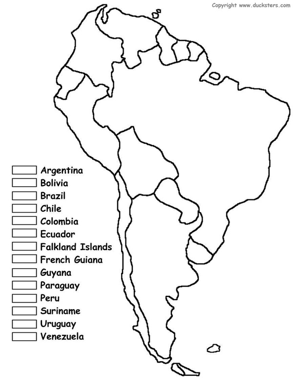 Fun Facts about South America: The highest point in South America is Cerro Aconcagua in the Andes Mountains in the country of Argentina. The largest South American country in both size and population is Brazil. The largest city is Sao Paulo, Brazil, which is also one of the ten largest cities in the world. North and South America were named after Italian explorer Amerigo Vespucci. The highest waterfall in the world is Santo del Angel (also called Angel Falls). It is almost 1000 meters high! The Atacama Desert in Chile is considered to be one of the driest places on Earth. Colonization Map 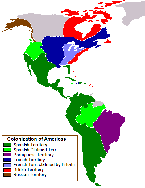 Population Map 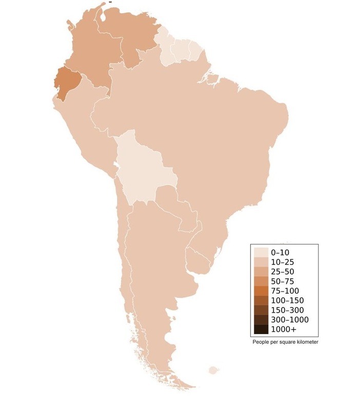 SATELLITE IMAGE 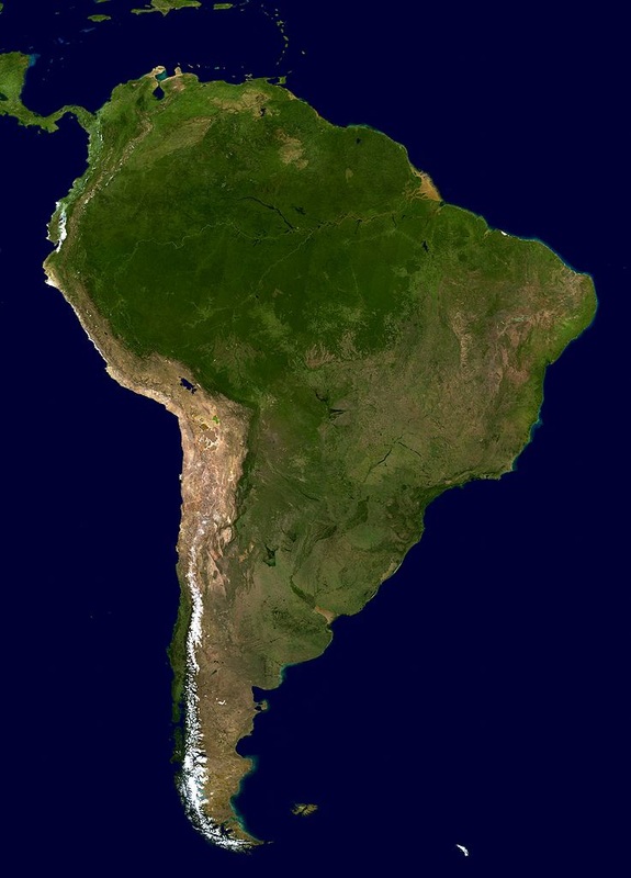 GAMES AND PUZZLES
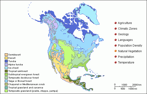
http://www.ducksters.com/geography/southamerica.php Compare the vegetation maps of North America and South America. 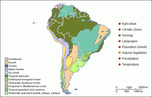
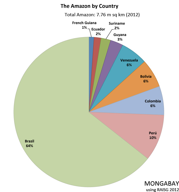
The Amazon Rainforest 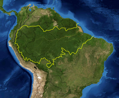
The era of piracy in the Caribbean began in the 16th century and died out in the 1830s after the navies of the nations of Western Europe and North America with colonies in the Caribbean began combating pirates. The period during which pirates were most successful was from the 1660s to 1730s. Piracy flourished in the Caribbean because of the existence of pirate seaports such as Port Royal inJamaica,[1] Tortuga in Haiti, and Nassau in the Bahamas. 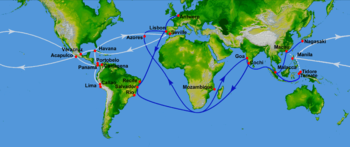
Were there is trade there are pirates. To combat this constant danger, in the 1560s the Spanish adopted a convoy system. A treasure fleet or flota would sail annually from Seville (and later from Cádiz) in Spain, carrying passengers, troops, and European manufactured goods to the Spanish colonies of the New World. This cargo, though profitable, was really just a form of ballast for the fleet as its true purpose was to transport the year's worth of silver to Europe. The first stage in the journey was the transport of all that silver from the mines in Bolivia and New Spain in a mule convoy called the Silver Train to a major Spanish port, usually on the Isthmus of Panama or Veracruz in New Spain. The flotawould meet up with the Silver Train, offload its cargo of manufactured goods to waiting colonial merchants and then load its holds with the precious cargo of gold and silver, in bullion or coin form. This made the returning Spanish treasure fleet a tempting target, although pirates were more likely to shadow the fleet to attack stragglers than to engage the well-armed main vessels. The classic route for the treasure fleet in the Caribbean was through the Lesser Antilles to the ports along the Spanish Main on the coast of Central America and New Spain, then northwards into the Yucatán Channel to catch the westerly winds back to Europe. 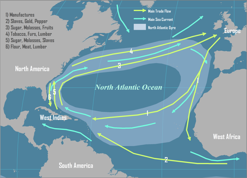
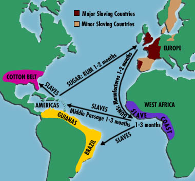
Piracy was sometimes given legal status by the colonial powers, especially France under King Francis I (r.1515–1547), in the hope of weakening Spain and Portugal's mare clausum trade monopolies in the Atlantic and Indian Oceans. This officially sanctioned piracy was known as privateering. From 1520 to 1560, French privateers were alone in their fight against the Crown of Spain and the vast commerce of the Spanish Empire in the New World, but were later joined by the English and Dutch. 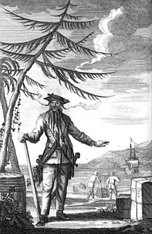
NicknameBlackbeardBornc.1680Place of birth(presumed) Bristol, EnglandDied22 November 1718Place of deathOcracoke, Province of CarolinaYears active1716–1718RankCaptainBase of operationsAtlanticCommandsQueen Anne's Revenge,Adventure
|
Archives
October 2015
AuthorWrite something about yourself. No need to be fancy, just an overview. Categories |
 RSS Feed
